Main Franconia from a geographic perspective: landscapes with character
Anyone who wants to get to know Main Franconia and understand its nature and essence should look at the region first from a distance. On a map of Central Europe you can find the region pretty much in the middle. And more importantly, internationally significant transport routes link the region to the rest of the world: the A 7 and A 3 motorways intersect at Würzburg, as do the parallel Intercity rail connections. Three other motorways branch out from Main Franconia. And the Main-Danube waterway traverses Main Franconia for 200 kilometres, enabling bulk freight transport by inland waterway.
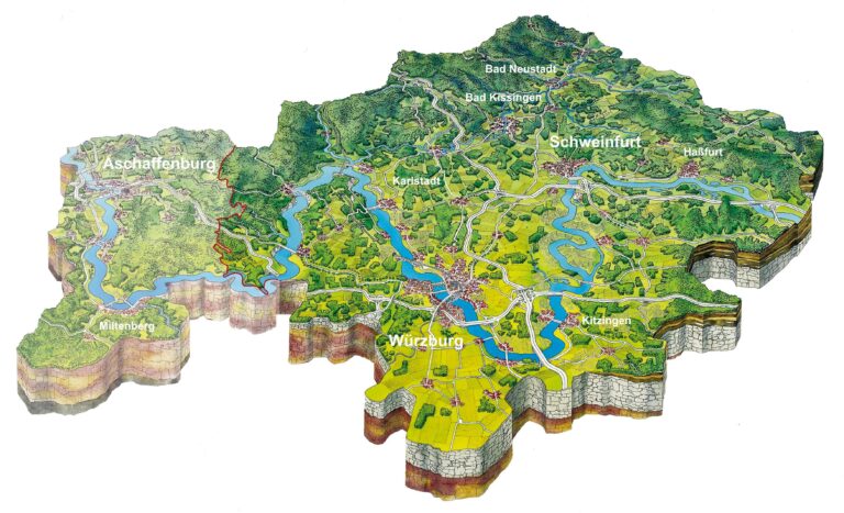
But that is already the result of mankind making the best use of its natural resources. Main Franconia’s basic structure already evolved millions of years before mankind settled here. It dates from the Mesozoic era, from the Triassic period. And therefore the basic structure of the Main Franconia landscape is also trimorphic: red sandstone, shell limestone and keuper. These three are the deposits from west to east, which originally superimposed one another, shifted into a slanted position during the Cenozoic era, then eroded at various levels, and now shape the diverse and enchanting Main Franconia landscape as well as its natural borders to the neighbouring regions (see Information).
The cultural landscapes of Spessart and Rhön were created on the red sandstone in the west. They are upland areas that were populated late on and formed linguistic boundaries with Hesse and Bayerischer Untermain. The Spessart is still the largest closed deciduous forest area in Germany. The Rhön stands out as an area of open expanses or endless horizons and impresses with its biosphere reserve with bare-topped hills with views far into the distance. Main Franconia’s only volcanic forms can be found here. The keuper escarpment in the east marks the beginning of Haßberge and Steigerwald, forested upland areas that separate Main Franconia from Upper and Middle Franconia. Between this lies the Main Franconia basin, also referred to as the Main Franconia plateau, which is characterised by shell limestone and partly covered by fertile loess loam. This core area of Main Franconia is lower, drier and warmer, and was therefore settled on earlier. The fertile loess-covered areas, which are used more intensively for agriculture than the forest mountains surrounding them, are also often referred to as “Gäu” areas (areas of open fertile countryside often intensively farmed).
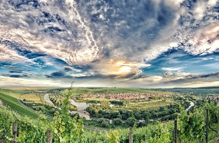
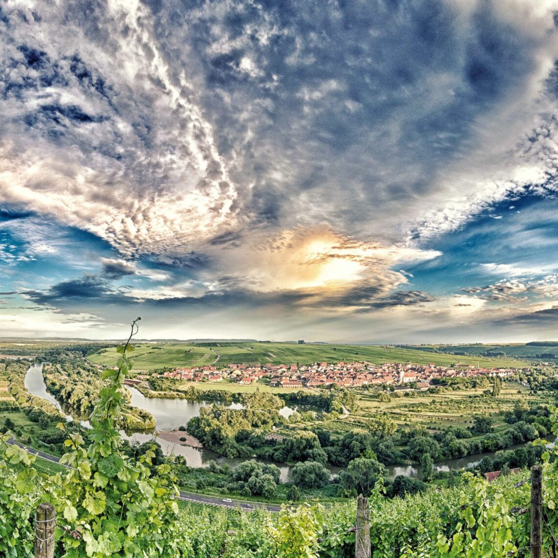
The Main has carved deep into the landscape in some of these plateaus, known as the “Mainfränkische Platten”. The character and essence of the Main Franconian landscape is unimaginable without the Main, which our region is named after. The Main, the longest east to west flowing river in Central Europe, meanders and winds 226 kilometres through Main Franconia, shaping the landscape, but also the development of settlements and economies. The Main and its tributaries, the Fränkische Saale, Wern, Sinn und Tauber, drain the whole of Main Franconia. In the area of the Main triangle it forms distinctive, steep-walled shell limestone valleys. This triad of extensive arable land, deep shell limestone valleys and framed forest mountains is the salient feature of the Main Franconia landscape.
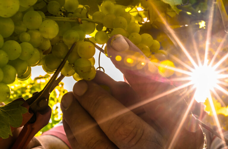
If you travel from Upper Franconia to Lower Franconia along the Main, you will immediately notice what the main difference is for the tourists here and what it is that defines the quality of life of the people in Main Franconia: the wine! The first vineyards come into view at Zeil am Main. Main Franconia is also known as “Weinfranken”. And if you follow the course of the Main, you will see that the sun-drenched slopes are covered with grapevines. The vineyards range from the Ziegelangerer Ölschnabel over the Obergheimer Höll, the Escherndorfer Lump, the Randersackerer Ewig Leben, to the Würzburger Stein and Homburger Kallmuth. The Franconian red wine region and with this Bayerischer Untermain, begins further west, beyond Wertheim.
Demarcations and definitions of Main Franconia are as numerous as they are varied. Some include Bayerischer Untermain while others include Bamberg in Upper Franconia. The most substantial definition and demarcation is that of the long-standing Würzburg geography professor and applied geography expert Alfred Herold. He describes Main Franconia as “the area along the Main, Tauber and Fränkische Saale, the open, old populated area between the forest landscapes which were settled on later, Odenwald, Spessart and Rhön in the West, Frankenhöhe, Steigerwald and Haßbergen in the East. Main Franconia also incorporates the part of the mountainous encircling region here which is culturally or economically orientated towards the core landscape.” We cannot completely ignore the political and administrative reality and in everyday use Main Franconia therefore currently usually also incorporates Lower Franconia without Bayerischer Untermain or, in other words, also the planning regions of Würzburg and Main-Rhön and with this the chamber area of the Würzburg-Schweinfurt Chamber of Industry and Commerce.
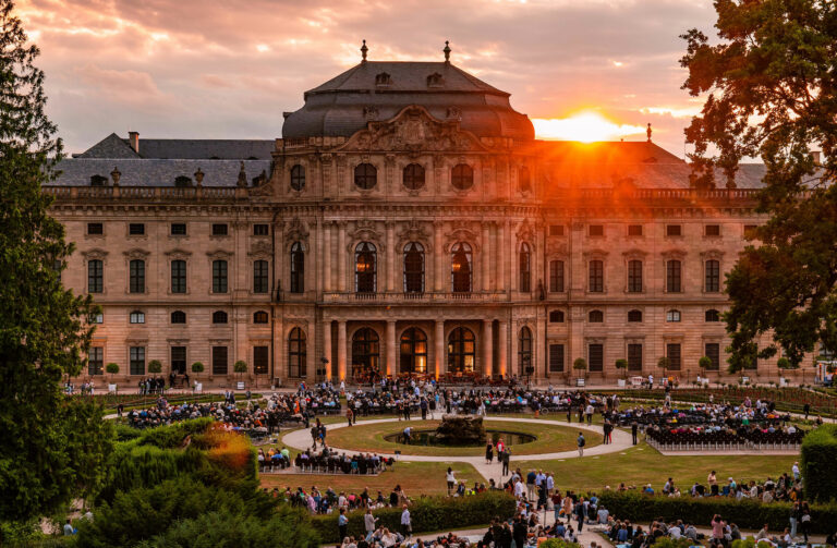
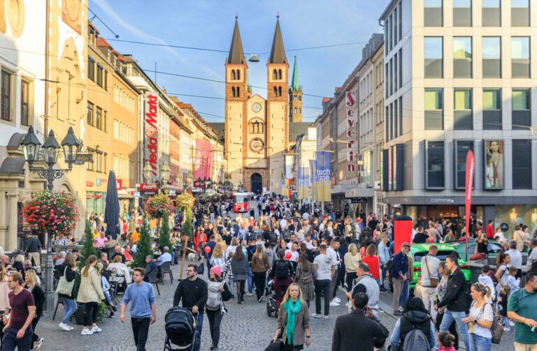
The wine lover Goethe was also passionate about the quality of life here – and the Würzburg wine. In 1806 he insistently wrote: “Send me a few more bottles of Würzburg wines, as I do not like the taste of any other wine and I am vexed when my usual favourite drink runs out!” Earlier, his Götz of Berlichingen announced: “Franconia is a blessed country!” And it really is. Quaint towns with picturesque forts and half-timbered houses are dotted along the River Main like a string of pearls. The highlight is the baroque prince-bishop’s city of Würzburg with its magnificent residence and Marienberg Fortress which sits enthroned on the vineyards above Würzburg. The most notable architectural and artistic gems in Main Franconia’s rich cultural landscape can be found here in the Main valley and along the Saale.
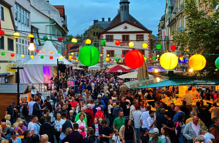
If you are seeking scenic extremes in Main Franconia, similar to those in the alpine mountains, you will seek in vain. It is, instead, the Main Franconian landscape’s aforementioned charming individual and separate parts, rich in their nuances, which combined with cultural wealth, relaxed urbanity and 270 wine-growing towns and villages, that attract people. More than six million guest overnight stays (before the coronavirus) in a region with just under one million inhabitants also proves that the region knows how to successfully market its appeal now.
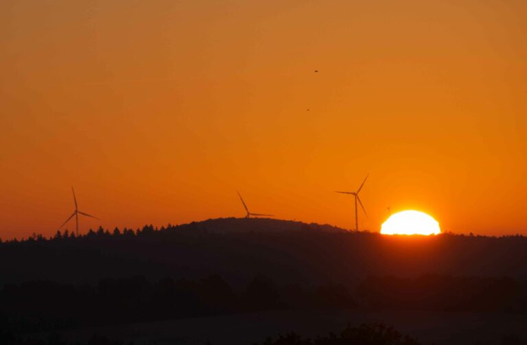
The Main Franconian region owes its attractiveness not least to the mild and sunny climate. However, there is also a risk here now and in the future as the region is a hotspot for human-induced climate change. Not only will rising temperatures, but also long dry periods and water shortages in the area of rivers and declining groundwater levels be a crucial challenge for Main Franconia.
Header picture: Magnificent view over the largest meandering river landscape in Bavaria – the Mainschleife – from Vogelsburg Castle in the district of Kitzingen Photo: Touristinformation Volkacher Mainschleife